
Backwoods Sculpture:Ossipee Mountain Range
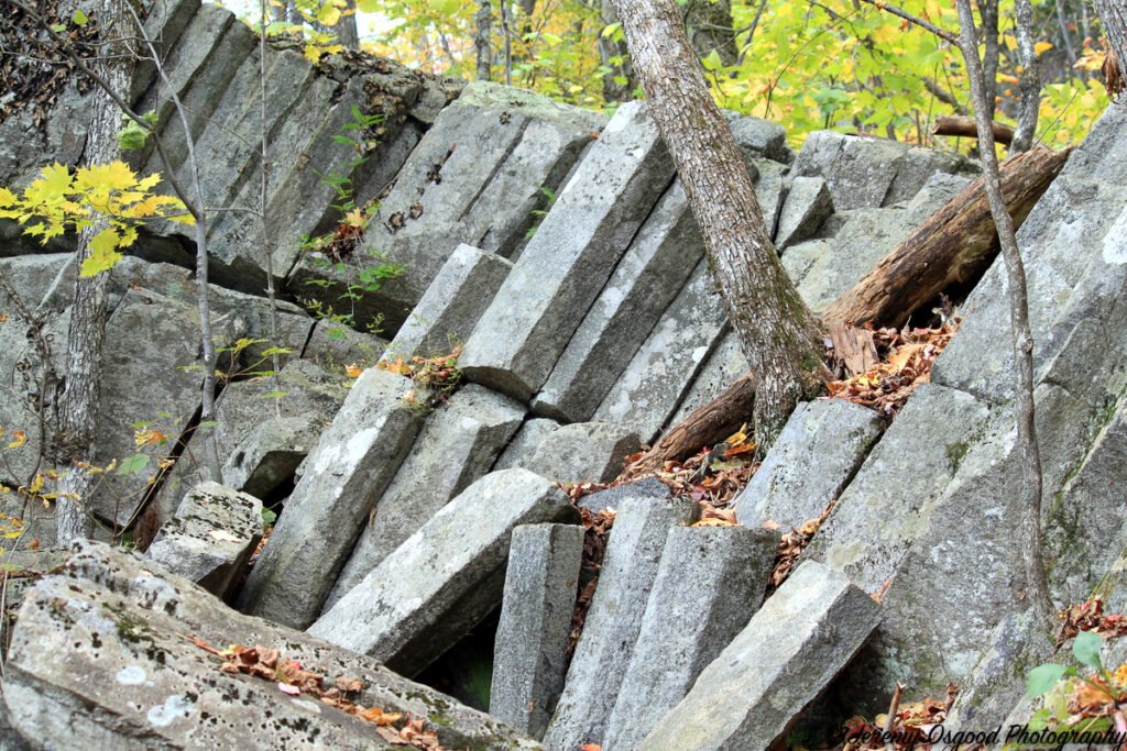
Volcanic magma: pressure and heat helped create the geological phenomonon known as columnar joining.
Photos from Mount Shaw
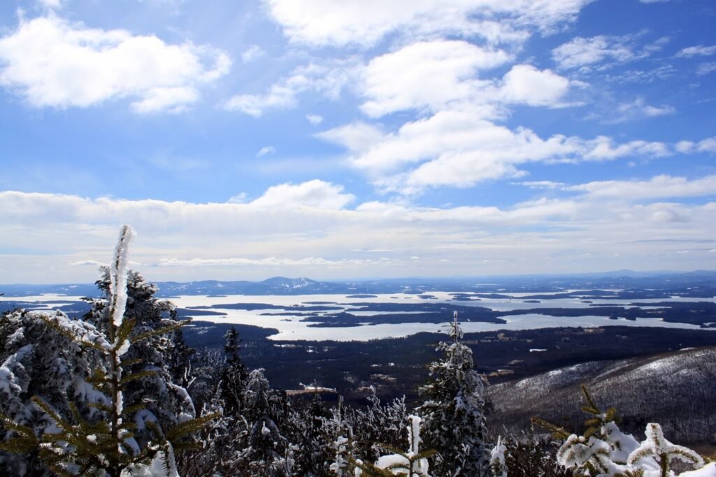
Winter day photos from the summit of Mount Shaw of Lake Winnipesaukee and also Mount Chocorua.
Painfully Beautiful, The Broads

Painfully beautiful, The Broads of Lake Winnipesaukee Adjectives are like Rumplemintz or fluff in your hot cocoa…easy to get carried away with but usually ends with a splitting headache. This view across the broads took a bit of a hike off Wolfeboro Neck on Lake Winnipesaukee, and the 0 degree weather and extreme wind gusts made it shockingly cold…but beautiful. I tried to take my gloves off to press the shutter and my hands froze almost instantly. The moisture inside my nose froze, making a snot popsicle. You get the picture in more ways than one. Have a good weekend!
All Aboard, Wolfeboro Nursery School
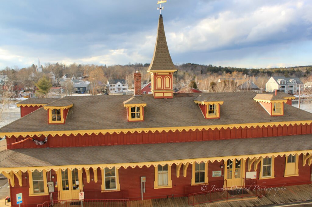
All Aboard Wolfeboro Nursery School How cool is it for a pre-schooler to attend school for the first time at the old train station? Well just ask a 3-5 year old and they’ll pipe up. I even attended way back in the day. Better yet, bring your child to the Open House on February 13th from 10am-noon. Meet, learn, explore and find out what this 50 year-old non-profit has to offer in giving your child a head start. My daughter just couldn’t wait to go to school here every day. They have two fantastic teachers in Paula Bechard and Donna Wood and it amazes me how parents and community volunteers sacrifice so much of their time and resources to keep the Nursery school thriving year after year. To learn more about the Wolfeboro Nursery School check out the link below. They also have a facebook fan page. Enrollment is open for next fall for Wolfeboro and surrounding communities so don’t get wait listed. www.wolfeboronurseryschool.org
Melvin Village from Winnipesaukee

crystal clear winter day provided a nice view of Melvin Village with the Ossipee Range as the backdrop
Mount Shaw and the Ossipee Mountain Range

Mount Shaw and the Ossipee Mountains This photo was taken at 8:54am this morning from Beech Pond Road near the Ossipee town line. If you like winter activities there is something energizing about a fresh snowfall. The sunlight was magnified this morning after two days of cloud cover and the snowflakes sparkled in the fields from the reflection. You could write volumes about the Ossipee Range and how it has shaped our landscape. From its geological features as an ancient volcanic ring dike that replenishes our aquifers, lakes, streams, and ponds to the 180ft deep Dan Hole Pond and its legendary lake trout, to the Algonquin Ossipee Indian sites, and supposedly a sacrificial stone somewhere on the side of Mount Shaw. My grandfather, an old ridge runner, has spent his life in these mountains starting as a young boy working in the old logging camps. It is quite an area to explore if you’ve got some time. This custom USGS map with updated road overlay really shows the strong volcanic origins of the range. http://en.wikipedia.org/wiki/Ossipee_Mountains
Lake Wentworth Sunrise
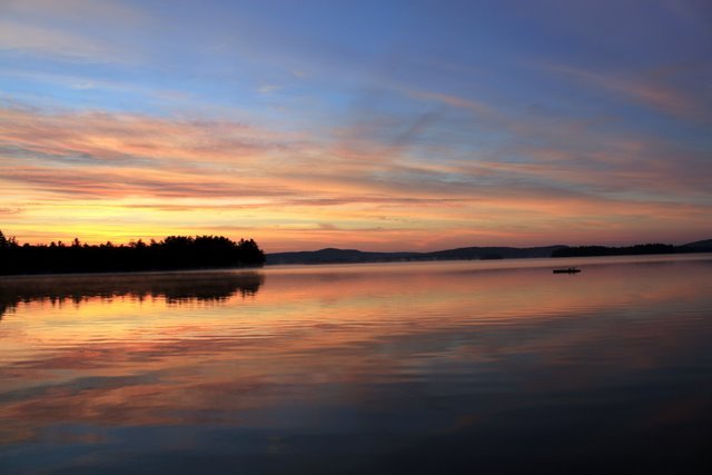
Lake Wentworth Sunrise Photo A crack of dawn wake-up reward…this photo was taken from the Bridge Falls path where the tracks split Fernald Basin from Wentworth. Wentworth freezes several weeks before Winnipesaukee and usually a week or so before Crescent Lake due to currents from the Smith river canal and the the Smith river dam that drain into Back Bay,Winnipesaukee. Wentworth is also relatively shallow with the deepest point at around 60ft out at Fuller’s Deep. The ice must be at least 8 inches thick now because i saw Stu pulling his winnebago “ice Palace” fish house out on the ice this afternoon. I’ll get a shot sometime this week. Update: Below I’ve posted a bonus image from a summer sunrise over Lake Wentworth